
Modifying Geofences
Based on your requirement, you can modify geofences in the Engagement server.
To modify a Geofence, follow these steps:
- Click the required geofence in the Geofencing list view.
The View Location page appears.
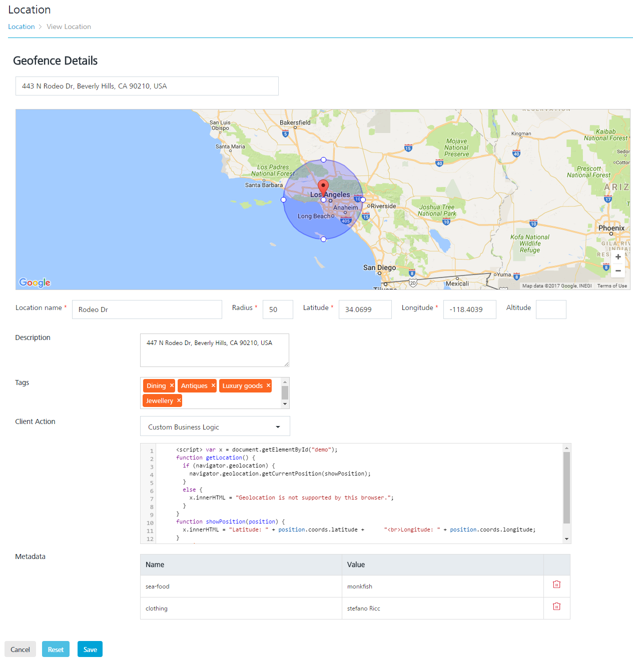
- Geofence Details: In the Geofence Details section, you can update the following fields:
Geolocation Element Description Modification Allowed Location Name Location name Yes Radius Circumference with location area specified Yes Latitude Latitude is a geographic coordinate that specifies the north–south position of a location on the earth's surface. Geographic coordinates are specified in decimal degrees Yes Longitude Longitude specifies the east–west position of a location on the earth's surface. Geographic coordinate are specified in decimal degrees Yes Altitude The height of a location in relation to sea level or ground level Yes Description Location description Yes Tags The user-defined tags that assign a label to a geofence for the purpose of identification, such as a ZIP code or an area code Yes Client Action There are three client actions when a user interacts with the Engagement server:
- Notify Engagement Server
- Local Client Notification
- Custom Business LogicYes Metadata Metadata refers to geographical information about media. For example, fileType and colorMode can be used to identify an image associated with a geofence. Yes - Click Cancel if you do not want to save the updated fields. The Location screen appears.
- Click Reset to remove the details in all the fields. You need to enter the new details in the respective fields.
- Click Save.
The updated location appears in the Geofencing list view. The system displays the confirmation message that the location updated successfully.